Sitemap

July 31, 1999 - Boulder River
Elevation Gain: 600 ft
Mileage (RT): 9 miles
Time (RT): 5 hours
Difficulty: Easy
Trailhead Location is Latitude 48:14.75 N by Longitude 121:49.3 W
  • Boulder River @ Seattle Citysearch
  • Boulder River @ Ken's Hiking Pages
  • Boulder River @ wta.org

    Related Book:
    100 Hikes in Washington's Glacier Peak Region

  • From I-5 drive Highway 530 east to mile point 41. Turn right on the French Creek Road FS #2010.
    Follow this to the road's end at 3.8 miles and an ample parking area.
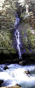
    Waterfall!!!
    Waterfall!

    490 x 1200
    br00005.jpg
    Welcome to Boulder River

    640 x 480
    br00012.JPG
    First glimpse of the falls

    480 x 640
    br00013.JPG
    "This hike is too easy!"

    480 x 640
    br00014.jpg
    The first waterfalls...

    480 x 640
    br00015.JPG
    ...and Amy enjoying them!

    480 x 640
    br00018.JPG
    Crossing the log bridge

    480 x 640
    br00030.JPG
    View of the river

    480 x 640
    br00042.jpg
    View from the lunch spot

    480 x 640
    br00043.JPG
    Chris's lunch spot

    640 x 480

    All photos Copyright © Chris Duval